1. Park Overview
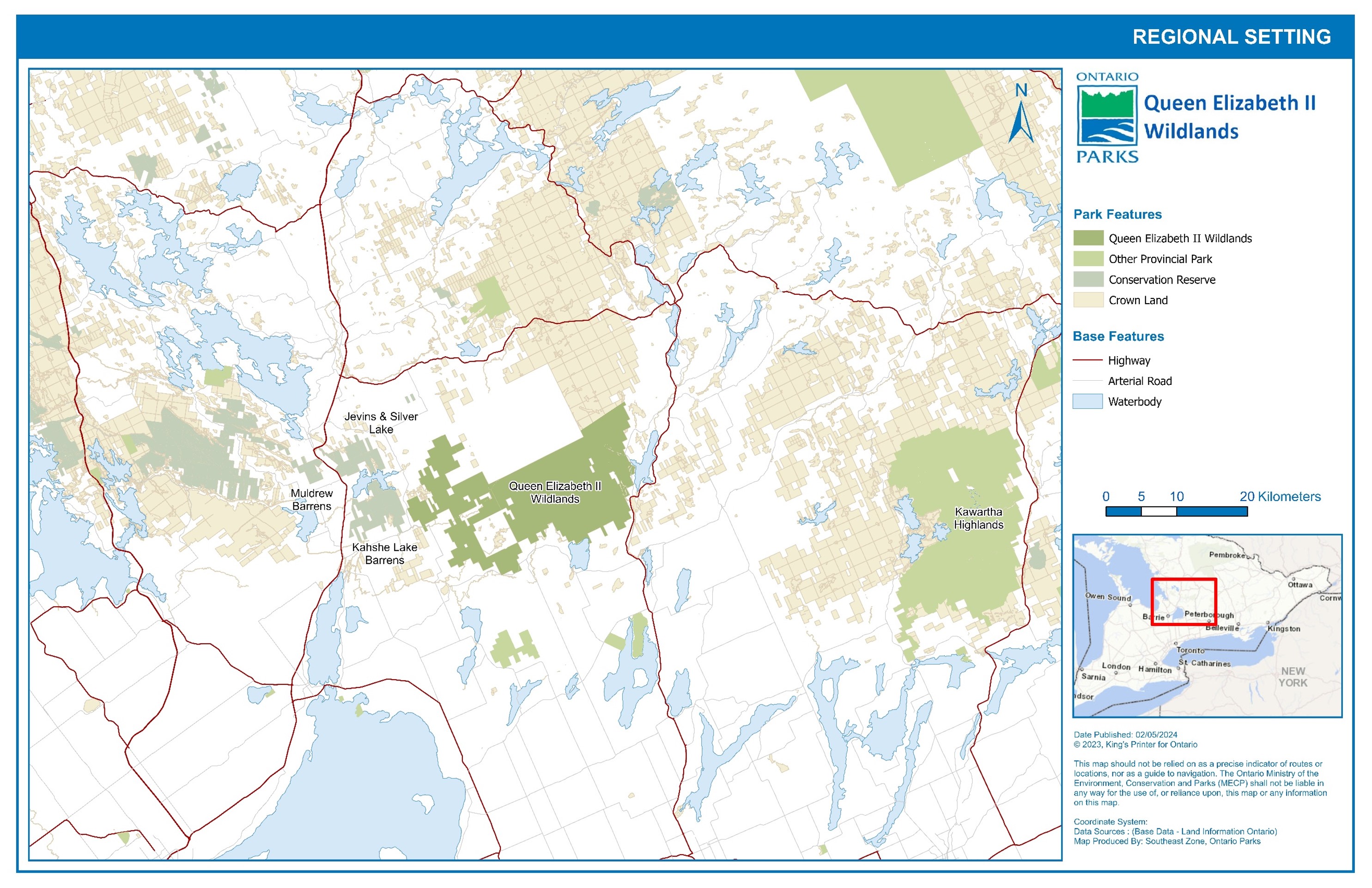
Queen Elizabeth II Wildlands Provincial Park (QEII) is a 33,505 hectare (ha) natural environment class park located 18 kilometres (km) south-east of Gravenhurst, 28 km north-east of Orillia and 10 km west of Minde
n (See Figure 1). The park is situated in parts of the District Municipality of Muskoka (Ryde township), City of Kawartha Lakes (Dalton and Digby townships) and Haliburton County (Anson and Lutterworth townships).
The park was regulated as Dalton Digby Wildlands Provincial Park on May 8, 2002, as a product of the expansion of the province's protected areas through Ontario's Living Legacy Land Use Strategy (1999). The park was re-named Queen Elizabeth II Wildlands Provincial Park in 2003 in honour of Her Majesty’s Golden Jubilee visit to Ontario. It is currently guided by a 2001 interim management statement.
The park is situated in Ecodistrict 5E-8, Ecoregion 5E (Georgian Bay Ecoregion). QEII represents one of the most ecologically diverse and intact landscapes in the region. The natural values of the park can be attributed to the variety of habitats present. The park is characterized by rolling rock barren ridges and troughs of shallow soil deposits, several lakes, and a rich variety of forested, non-forested and wetland vegetation types. It protects provincially rare species, significant natural areas, and has potential for sites of archaeological and cultural importance.
Wildlife corridor mapping shows that the park is an important intersection for animals migrating both east/west and north/south in Ontario which is increasingly valuable in light of urban development and climate change.
The park is an important recreational resource long used for backcountry camping, hunting and fishing. The open landscape, with rocky ridgelines, small lakes, and wetlands, is generally suited to backpacking trails. Campsites are available on several lakes within the park.