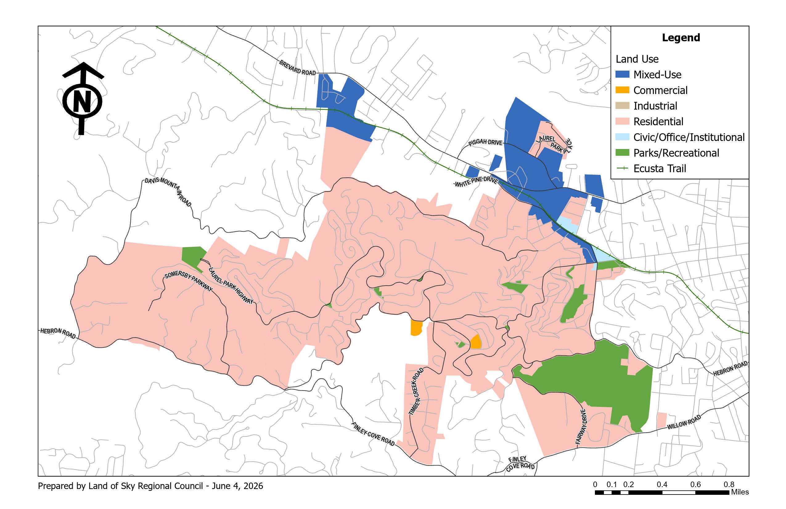
What is a Future Land Use Map?
The Future Land Use Plan bridges the gap between Laurel Park’s existing land use pattern and the desired pattern of future investment. It translates the Comprehensive Plan’s goals into a map and policy framework that can guide Planning Board recommendations and Town Council zoning decisions. It also helps the Town prepare zoning statements of consistency as required by state law.
Most importantly, the Future Land Use Plan helps Laurel Park make better long-term investment decisions. It provides a framework for deciding where public infrastructure, transportation improvements, stormwater improvements, parks, trails, utilities, and municipal services should be prioritized. It also clarifies where redevelopment and infill may strengthen the Town’s financial position without compromising the residential and environmental qualities residents value.
The Future Land Use Plan should be used to answer a practical question: how can Laurel Park protect its identity while building the service capacity and tax base needed to remain a high-performing municipality?
Is This a Rezoning?
The Future Land Use Plan is not a zoning map and does not rezone property. An area zoned R-20 today will remain R-20 unless the Town completes a formal map amendment or ordinance amendment process. The Future Land Use Plan is a policy guide. The zoning ordinance and zoning map remain the legally binding documents that establish zoning districts and development standards.
This distinction is important for residents. The Future Land Use Plan does not automatically change what can be built on a parcel. Instead, it helps the Town evaluate future requests in a consistent way, grounded in the Comprehensive Plan, public input, infrastructure capacity, environmental constraints, and the Town’s long-term financial responsibilities.