
Western Coulees and Ridges Draft Regional Master Plan - Public Input Survey
Thank you for taking part in the public input process for the Western Coulees and Ridges Draft Regional Master Plan. The Western Coulees and Ridges Draft Regional Master Plan describes proposed resource and recreation management for DNR properties in the Western Coulees and Ridges Ecological Landscape (WCR EL).
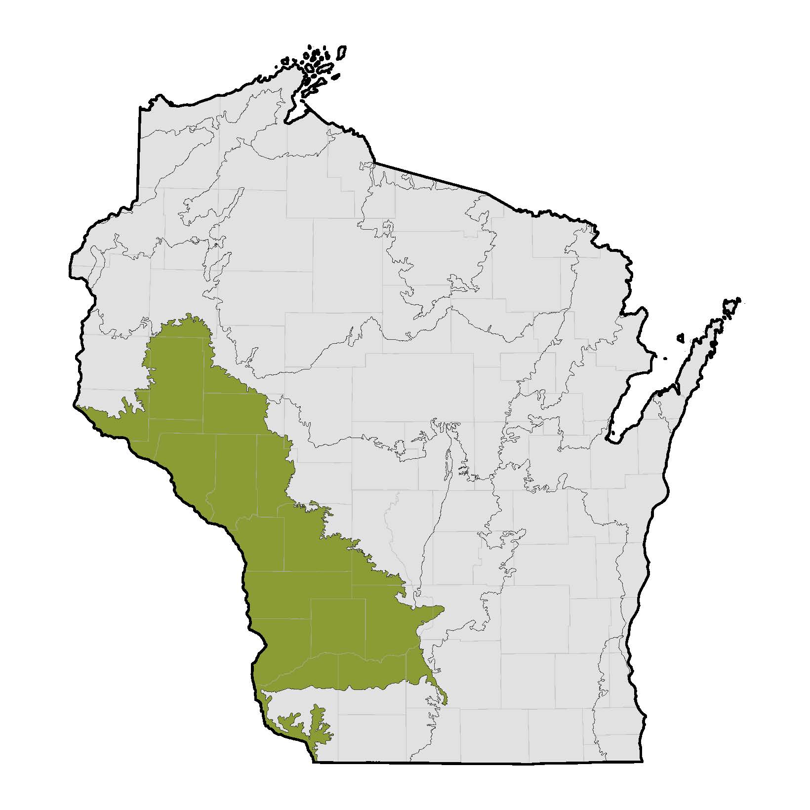
The WCR EL is located in the Driftless Area of western Wisconsin and includes all or portions of Barron; Buffalo; Chippewa; Clark; Columbia; Crawford; Dane; Dunn; Eau Claire; Grant; Iowa; Jackson; Juneau; La Crosse; Monroe; Pepin; Pierce; Richland; Saint Croix; Sauk; Trempealeau; and Vernon counties. The region encompasses over 17% of the state's total area and approximately 11% of the department's managed land.
The WCR EL is located in the Driftless Area of western Wisconsin and includes all or portions of Barron; Buffalo; Chippewa; Clark; Columbia; Crawford; Dane; Dunn; Eau Claire; Grant; Iowa; Jackson; Juneau; La Crosse; Monroe; Pepin; Pierce; Richland; Saint Croix; Sauk; Trempealeau; and Vernon counties. The region encompasses over 17% of the state's total area and approximately 11% of the department's managed land.
DNR properties within the WCR EL include fisheries properties, state natural areas, state parks, state recreation areas, state trails, wildlife areas, and a variety of other types of properties. Some properties have previously approved NR 44-compliant plans which are being incorporated into, and updated as part of, the Western Coulees and Ridges Draft Regional Master Plan.
We encourage you to complete this survey and provide your input on proposed resource management, public use, and real estate actions for the DNR properties in this region.
The survey provides the opportunity to comment on general topics and individual properties. You may comment on as many or as few properties as you wish. If you do not wish to comment on a portion of the survey, simply click on the option indicating no interest in commenting and you will be taken to the next section.
If you do not complete the survey by getting to the last page and pressing "DONE" your responses will not be recorded.
If you do not complete the survey by getting to the last page and pressing "DONE" your responses will not be recorded.
Please note that this survey is gathering input for DNR properties only. Federal, county, and municipal lands are not included in this plan or this survey.
This survey will first ask questions about specific recreational issues on two properties where the DNR is considering changes to public use and is seeking public input on several alternatives in order to identify a preferred alternative. This will be followed by opportunity to provide input on individual properties and lastly an opportunity to provide general comments.
The complete plan is available here.
An executive summary of the plan is available here.
Learn more about the plan and the region on the Western Coulees and Ridges Regional Plan webpage.
Your feedback is extremely valuable to us!