Ashley Scenic River Public Survey |
Introduction
The South Carolina Department of Natural Resources (SCDNR) and the Ashley Scenic River Advisory Council are seeking public input to help update a management plan for the Ashley Scenic River.
The management plan identifies priorities for protecting and managing the river's scenic, natural, cultural, and recreational resources. As a river user, nearby resident, or community member, your experiences and perspectives will help guide the goals and objectives to be outlined in the plan.
This survey contains 19 questions and should take approximately 20 minutes to complete. The survey will remain open and accessible on the Internet through October 31, 2026. You may return at any time before the closing date to complete or revise your responses.
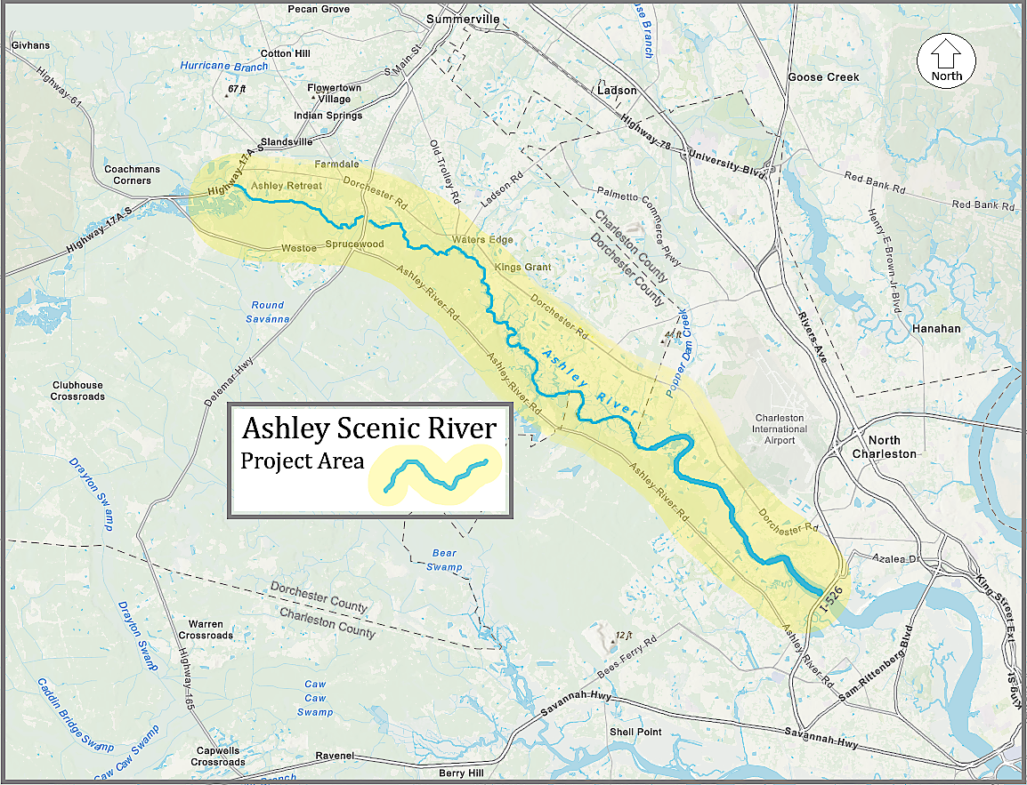
The questions focus on the Ashley Scenic River and adjacent lands. The designated scenic river corridor includes a 22-mile section of the Ashley River in Dorchester and Charleston counties, extending from the Highway 17-A bridge crossing downstream to the I-526 (Mark Clark Expressway) bridge crossing.
Please review the map below. The highlighted section of the Ashley Scenic River corridor is the focus of this survey.